|
|
|||||||||
 County |
 City / Town |
 Directory |
 Maps |
 Contact Us |
 Advertise |
 Showcase |
 Calendar |
 Association |
 Passport |
Used by historic Utes on their migrations, and ancient native American Indians as trade routes, the Spaniards discovered the trails in their quest for treasure and territory between 1598 and 1821. Mexican and American traders and adventurers (1821-1830) connected these native trade routes to complete the Old Spanish Trail. One segment, now called the West Fork of the North Branch, is perhaps the oldest, having served travelers for nearly a thousand years.
The trail as we know it today began as a trading route west from Santa Fe, New Mexico to Los Angeles, California. The early Spaniard Colonists sought to link their two most populous northern regions, the upper Rio Grande in New Mexico, and the California coast, in an attempt to forestall incursions into their territory by the English, French, Russians, and Americans. Hostile Indians blocked a direct route across Arizona as effectively as the long, waterless stretches and the cliff-bound Colorado River. Sanctioned Spanish expeditions from Santa Fe to central Utah included those by Juan Maria Antonio de Rivera in 1765, and Franciscan Priests Dominguez and Escalante, who explored a route from Santa Fe to the Great Basin in 1776. Later Francisco Garces explored the area from the Colorado River to the California settlements but did not link up with the 1776 route.
In 1821, Spanish dominion over the Southwest passed to the Republic of Mexico, and Mexican traders revived attempts to reach the California settlements. Upon learning of the exploits of Jedediah Smith in 1826 and 1827, a Mexican merchant named Antonio Armijo managed to connect the entire route and launch the first commercial venture to California from New Mexico in 1829.
This original trail, now called the South Branch of the Old Spanish Trail, witnessed an explosion of activity between 1830 and 1843, when Mexican and American traders shipped Navajo Blankets and woolen goods west by mule train. These products were exchanged in California for mules and horses which were resold in the New Mexico and Missouri Markets.
Frequently these caravans consisted of thousands of animals, requiring vast grazing areas and adequate water supplies, resources that would consequently become scarce along broad expanses of the trail. An alternate route was developed which became known as the North Branch of the Old Spanish Trail. This trail was divided into an East Fork and a West Fork because the Canyon of the Rio Grande prevented one common route. The Spaniards had learned early on that the only way to travel north through the San Luis Valley was to either skirt the west side along the San Juan Mountains, or the eastern boundary along the slopes of the Sangre de Cristo Mountains. The center of the Valley was so marshy during the late 18th and early 19th centuries that the Spaniards identified Saguache Creek as the headwaters of the Rio Grande.
Because of these two forks on the trail, the East and West converged at present day Saguache, becoming one to go west over the Continental Divide, then follow the Gunnison and Colorado Rivers to meet the South Branch near the Green River in Utah.
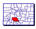
Saguache County can claim another route, going east and north over Poncha Pass. More of the Old Spanish Trail is within its boundaries than any of the other 29 counties along the six state route.
A group from Del Norte formed the Old Spanish Trail National Association in 1993. Organized in September 1994, the Saguache County Chapter continues to search for over 110 miles of this historic trail. Much of the trail crossed over land now in the hands of private owners, and is even buried under modern highways.
Studying the journals kept by Spanish explorers Don Diego de Vargas (1694), Juan Bautista de Anza (1779), Manuel Segura 1787, followed by Zebulon Pike (1807), Jacob Fowler (1821), Antoine Robidoux (1824), George Ruxton (1845), and trappers and traders Ewing Young, Etienne Provost, George Yount, and Kit Carson, to name a few, and Capt. John W. Gunnison during his US Government expedition in 1853, we have been able to slowly follow the paths they took. Mile by mile, the trail reemerges.
The Saguache County Chapter’s goals are to continue documenting the trail, position interpretive signs at significant locations, and erect signage at highway crossing sites to revive this long forgotten historic trail for future generations. All interested persons are encouraged to join in the hunt.